
From Dark Fleet to Decision Point: How Venezuela’s Maritime Gray Zone Was Exposed
Jun Kajee
Share
A Hidden Network Moves Sanctioned Oil
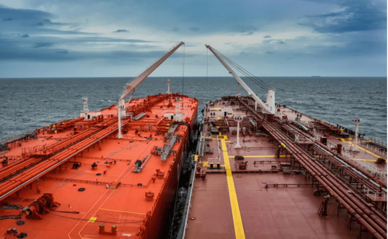
For years a network of shady oil tankers and supply ships has quietly moved Venezuela’s crude oil despite strict U.S. and international sanctions. Collectively these vessels are what researchers call shadow fleets or dark fleets: ships that use deceptive tactics to hide what they’re carrying and where they’re going.
For open‑source intelligence (OSINT) practitioners and enthusiasts, the full story of Venezuela's dark fleets wasn’t initially obvious. By late 2025, however, watchers pulling together publicly available data — like ship tracking services, satellite imagery and maritime risk reports — started to see something bigger taking shape.
How analysts began to peel back the curtain started with a basic understanding of how dark fleets operate in the maritime "gray zone":
Common Tactics Used by Dark Fleets
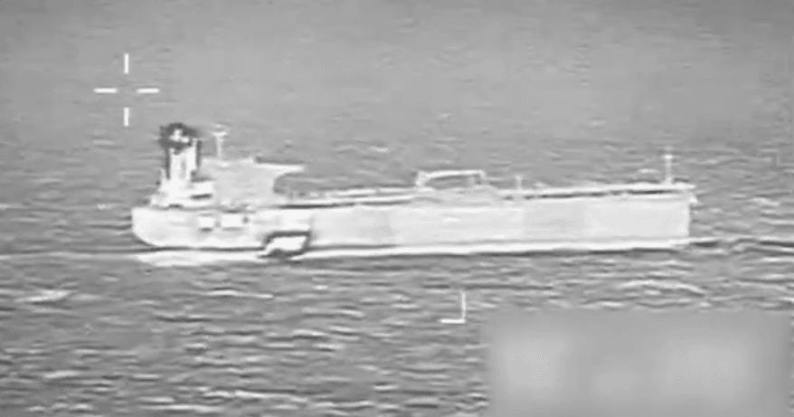
- Manipulating AIS (Automatic Identification System) signals: Normally every ship broadcasts its location so other vessels can avoid collisions, as required by the International Maritime Organization. Some ships simply went "dark" or "spoofed" their identities or locations.
- Ship‑to‑ship transfers: Instead of loading or unloading oil in a port, illicit cargo is frequently transferred at sea to avoid detection.
- Flag hopping: Shadow-fleet ships often change the country they’re registered under — usually to a country with looser oversight — to confuse trackers. This registry change is frequently faked for AIS purposes.
- Opaque ownership: Shell companies and hidden ownership chains make it hard to tell who’s really behind a vessel.
OSINT analysts refer to ships who use these tactics as high‑risk vessels -- those flagged as likely tied to sanctioned or illicit activity.
Patterns Emerge
These behaviors often appear as oddities — a ship goes dark here, another pops up under a different name, etc. But analysts studying the ships operating near Venezuela had plenty of reason to suspect there was more to the story. As they started tracing movements over weeks and months, a clearer picture formed:
- Some vessels consistently showed up near known oil rendezvous spots — places offshore where cargo could be swapped between ships.
- Others kept ending up near drug‑interdiction routes identified by international law enforcement.
- Over time, some ships appeared repeatedly in both kinds of locations — suggesting there was selective overlap between oil smuggling and other illicit activity.
- These patterns weren’t random. They suggested adaptation and coordination, not mere accidents like signal errors or bad weather data.
Why This Matters: The Role of State‑Linked Ships
Observers also began to notice that government‑linked vessels — ships clearly connected to Venezuelan state interests — were often nearby when these opaque operations took place. These might not confront foreign surveillance ships and aircraft directly, but by shadowing "approved" high‑risk commercial ships they could facilitate their unobserved navigation.
That’s a classic “gray‑zone” move: you don’t start a confrontation, but you send a signal. In doing so, however, you also reveal where your vulnerabilities lie, provided someone is paying attention.
Open‑Source Tracking Didn’t Start the Action — It Informed It
In early January 2026, U.S. forces conducted a major military operation in Venezuela that resulted in the capture and removal of President Nicolás Maduro from power, an action widely reported by international outlets as part of a broader escalation of pressure on the regime.
OSINT tracking data had already helped planners understand ship movements and response times in the region, and in the weeks leading up to the intervention several sanctioned tankers were seized or intercepted by U.S. forces in Venezuelan and Caribbean waters as part of an effort to enforce sanctions and constrain Venezuelan oil exports.
This open-source tracking did not itself trigger the operation; instead, it reduced uncertainty for decision‑makers, giving them a clearer picture of activity on the water that complemented classified intelligence. In other words: OSINT helped inform strategic choices, but it did not drive the decision to act.
The Big Lesson for OSINT Enthusiasts
Here’s the key insight that emerges from watching Venezuela’s maritime activities:
The same secrecy that helps gray‑zone operations survive also makes them vulnerable — if someone watches long enough.
That’s because:
- Continuous deceptive behavior creates patterns.
- Turning off trackers repeatedly stands out over time.
- Many “dark fleet” tactics leave artifacts in data that only show up when you look for them consistently.
Venezuela’s maritime gray zone shows a central paradox of these kinds of operations: the very opacity that sustains them also generates observable patterns when monitored persistently. With careful, continuous observation across multiple open sources — ship tracking, satellite imagery, ownership databases — OSINT analysts can reduce uncertainty, expose critical dependencies and give decision‑makers information they wouldn’t otherwise have.
Gray‑zone actors rely on inattention — the hope that no one will keep watching. When the attention stays steady, their strategic margin narrows — often decisively. And that’s exactly why maritime OSINT matters. It’s not just descriptive: over time, it changes what we can know — and what those who rely on concealment cannot hide.


